Tuesday, September 6, 2011

ADK New Slide Alert!

With all the destruction to the East Coast by Tropical Storm Irene it may be hard for anyone to see a possible positive side to the storm. But, the following photos are a testament to one possible positive side effect... New or improved slides in the High Peaks Region! Jeff 'Sensei' Murray, a close friend and great ski partner, offered to take me up in his plane and survey what the 'damage' to the peaks was.


Yes thats right! A western style chute right here in NY! The Trap Dyke, on Mt Colden, has for years been an East Coast winter mountaineering objective. In recent years it has been getting skied with a rappel over a steep icy section towards the bottom. It looks like now, after Irene, that steep section may be filled in enough to ski without the rappel and the new slide directly from the summit into the chute looks to makes skiing from the true summit that much better!


This is Ottis Gully, on Mt Colden also. It has been getting skied for years as well. The difference is now, post Irene, that the gully got scrapped clean and the runout at the bottom appears to go right to the trail! No more bushwhacking to get to/from it!


The slides on the left are the Angel Slides on Wright Peak. The new slide to the right; as of now is unnamed, as far as I know. Besides an entirely new slide to ski this winter, the big difference here is also the approach. From the lake in the lower right corner to the Angel Slides was about a 1/2 hr. You can see how much closer the new slide comes to the lake. It appears to cut the approach time by at least a 1/3!


There were 3 other new/improved slides of skiing significance but I did not get good photos of them. Check out Drew Haas's site at www.adkbcski.com for photos. The ones to check out are the slide on the North face of the Wolfjaw's, the slide on the South Face of Upper Wolfjaw and the slide on the North East face of Saddleback. These all appear to have easy/improved access and look like a ton of fun to ride!


So I know that winter for most of the boyz usually starts in the next 2 months. Well here in NY we have a little bit longer to wait but this year we have some new terrain to explore when it does finally happen!


-The Dude


Thursday, September 1, 2011

SE Wall of Tanner's Gulch: February 17, 2004

February 17 was ordained to be a throw-away day. We were in the tail end of a massive inversion. Baldy had been open for 5 days, Alta was bump city, and the obvious back country lines had long since been tracked out. The inversion was showing signs of weakness; snow was on the way, but the 17th was to be the transition. Flat light, wind, trace - 1": a day most chose to sit out and patiently wait for the next storm.

Well, I've never been one to waste a day when the stability is good and I knew a few like thinking individuals. Gremmie, Pow, the PA Prince, and I met at the cat shop before dawn with Coalpit dreams, but clouds had obscured the top of North Thunder. So it was on to Plan B: check out the Pearls, but there was not enough snow at that low elevation. I had one more idea: Plan C would be Maybird Couloir. The big walls would help with the flat light and my personal buffalo herd would set the booter.

The team set off in high spirits which quickly descended into skepticism. The west facing aspect above the chute had dump tons of manky snow into the gut of Maybird over the prior week. Of course this had consolidated into roughly 1,000' of frozen basketballs. Despite this omen, we continued upward. Eventually Maybird Chute transitions into a ridge the continues onto Sunrise Peak. About 400' below the summit, it was time to assess the situation. We had three options; none were super appealing.
  1. Ski back into the Maybird frozen wet slide mess
  2. Drop blindly off towards Lisa Falls
  3. Drop blindly off towards Tanner's
Based solely on the location of the vehicle, Plan D would be the Tanner's side. This line is highly visible from upper LCC and it is true a classic. You get a great view coming across the EBT, from Eddie's, and at the top of the Tram. Right there in plain sight, but it is often overlooked. Hell, I had never even registered it as a ski decent in my 5 seasons as an Alta employee and thus never paid it no mind.

SW Wall Tanner's
(taken at a much later date)

Gremmie dropped in blind at a weakness in the humungo cornice (where the ridge doglegs slightly and becomes illuminated). Success was not guaranteed. We'd stop often and deliberate and hem and haw. We snaked back and forth over small spines and linked small batches of turns where possible. The skiing was not overly difficult but the unknown factor coupled with obvious deadly exposure made for slow deliberate schussing. The snow started fantastic but transformed into an ever thickening crust. There was no idle chatter; it was tense.

The expanse up high had shrunk into a tight winding funnel. There were 2 distinct cruxes, the 2nd (easier) crux was documented. In the funnel, my preffered style was the controlled jump turn. Sloughs from each turn fell away down the fall line cascading over cliffs. The funnel pinched. Gremmie dropped the knee and made it look like Mambo. I down climbed through scrub trees and hollow chalk snow with skis on as the pitch approached 55°. I was having a not-so-flattering conversation with myself regarding my decision making skills. Against odds I had made it. Now the real heart burn began as I watched Pow and the Prince enter into the funnel, but they made it look easy. I soothed my ego by philosophizing that they were able to steal my sweet moves via careful observation.

The team regrouped. What lay before us was a wide 40° gully rolling gracefully into the bottom half the standard Tanner's route. Success!! Despite our complete lack of preparation we were into familiar terrain, and 1 hour after Gremmie made his first tentative ski cuts, we hit pavement.


Once back in the safe confines of Alta, I was able to study this shot. So big and obvious. Most lines in Upper LCC look incredibly difficult, but this is usually an optical illusion. Suicide, the summit pyramid of the Pfiefferhorn, Superior, and even parts of Eagle's Nest come to mind. But this is not the case with the SE Wall of Tanner's. What you see it what you get. Tense, puckering, unrelenting with so many close-outs. So many ways that don't go. But with the help of an unseen hand, we somehow had made it through.

- U.K.


Wednesday, August 24, 2011

Lake George Valley: August 21

Wild Bill and I set off from the Birchwood Airport is his experimental Super Cub. I thought my "experimental" phase had ended back in college, but I was wrong. We flew up Peter's Creek deep into the Chugach State Park. Features that I only had seen on maps came into view: Wall Street Glacier, Peril Peak, The X, the North Couloir on Rumble (props to O.G.Z.), Bee's Heaven, Peril, the Whiteout, and on and on. Our destination was the Lake George Valley.

Lake George Glacier calves in to Upper Lake George which forms a braided river flowing to Inner Lake George. Here the geography gets interesting. The Knik glacier descends 13,000' crossing the Lake George Valley at a 90° angle, and smashes against the opposite mountainside creating a 10 km wide dam. Before the globing warming myth became part of the public consciousness, this dam would hold water (unlike the theories put forth by global warming "scientists"). A massive lake would form behind the Knik Glacier flooding the Lake George Valley. Pre-1900 this lake would crest the glacier every 15-20 years resulting in an epic jökulhlaup which would wipe out the occasional native village. After 1915, the temporary lake would breach the glacier every year in June or July with a resulting 2 week flood. Since 1966 the Knik had failed to advance enough to seal the flood channel. What remains is a narrow 10 km channel along the face of the Knik and the mountainside known as "the Gorge."

We sussed out the former lake bed between the 2 lakes for a proper landing zone. Our preferred site was too rocky and we settled on a site a few miles down river.

Sussing an L.Z.

Pigheadedly, we decided to march towards a drainage that we sussed out on a series of fly-bys. That drainage would be key to getting above tree-line and onto the ice without too much bushwhacking. After crossing 2 channels of a river that our map showed as a pre-1900 lake, we reached the mountain side. We continued upriver ("uplake" according to the map). The valley took a right and all the channels of the lake converged into one massive channel of churning silty 32°F trouser warming intimidation. To continue "uplake" we would have to get on a 1/4 mile 5.7+ vertical traverse a few feet above the ragin' lake.

Wild Bill Lakeside before it Got Scary

We opted to turn left and start our climb rather than traversing the cliff face sans gear.

You're definitely in Alaska when you willingly enter into a soul destroying thicket with your ice ax on the outside of your pack thereby adding a 3x misery multiplier. Nobody likes to bushwhack, but Bill and I tolerate better than most. A close friend had volunteered the only advice you need for this type of endeavor: stay on the critter trails. Easy, peasy. With this handy tip, we marched confidently into the thicket and promptly got our asses handed to us for the next 7 hours.

Operation: "Creative Swears II" was under way:

"Nancy Reagan's mastectomy", lamented Keith.

"Danica Patrick's nuts," posited Bill.

But in the madness came berries, a bounty of berries:salmon berries: big, ripe, and plentiful.

"Astronaut cocks! Oh, these are good! Kitten dicks! So juicy and plump! Baboon ass crack! Delicious! Gandhi's balls! I'm stuffed!"


Lake George Glacier from our High Point

Crown Peak from the High Point

The brush had started to thin, but the ridge we had chosen only brought us to a local high point. To go any further, we would have to descend, cross a swamp, and bushwhack into an area of sheer cliffs. With unhappy skin and full stomachs, we knew it was time to head back. The ascent had some moments of touch and go, so we decided to find another route down. Despite our attempts to avoid the steep and wet, we had to rappel a near-vertical section so thick, you couldn't see below your waist. And by rappel I mean, doubling some cordolet around a willow and looping the cord around the small of your back.

After skirting several cliff bands, we emerged lakeside along the raging river. Somehow our 2 morning crossings had turned into 5 afternoon crossings (2 of those f'ers were waist deep). Anyone would have lost it by now, but Bill doesn't give a shit. We were barefoot and wet when we found the stashed airplane; however, blue skies and warm temps made this a pleasant experience.

The flight back was spectacular. We did some more scouting looking for LZs where it would be easy to hike above tree-line. Blue skies and calm winds allowed a for leisurely sight seeing back to Birchwood.

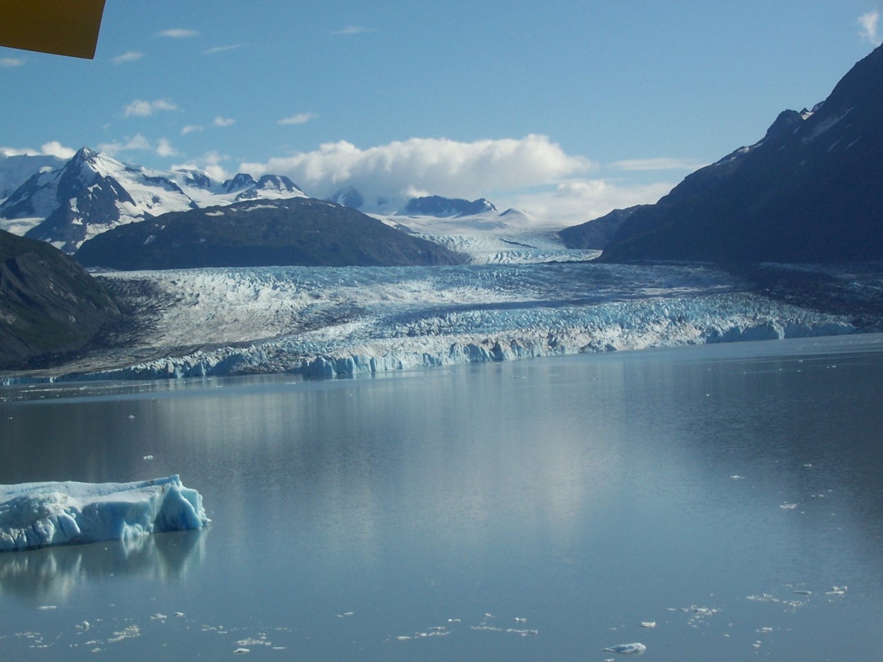
The Gnarl of the Knik Glacier

Colony Glacier Calving into Inner Lake George

Flying Down "The Gorge"
This glacial face would smash against the mountain creating the dam

Another great day of get humbled by the Chugach capped off by an Unibroue Fin du Monde!
Happy Baby Wild Bill Day!

- Big Dave Brewster
Friday, August 19, 2011

Isolation Traverse


So here in Washington we also benefited from La Nina. And in the first week of June skiable snow still reached down to just under 3000 ft. I was fortunate enough to head up to Cascade Pass with three promising recruits to the PNW division of the Skier Boyz franchise.

The terrain was awesome and we managed to keep things nice and light -- 7 days worth of food, shelter, fuel and gear into 35L packs. Long days and great weather, with only a little stretch of low vis in the middle, made for a fun trip. We took our time heading North from Cascade Pass towards Eldorado and eventually pushing all the way to Diablo and the car that held the precious celebratory barley soda-pops. With two layover days there was plenty of time to get some turns in. After dinner corn skiing and some steeps in between. Check out the full trip report and pictures taken by both myself and Jason Hummel at:


Additional images of Jason's can be seen at:


I'm already fired up about the coming season and reuniting with Boyz (and Girlz) in AK, Utah, and anywhere else we might bring together big turns and deep snow (and maybe a little brown liquor).

~GB6K

Monday, August 15, 2011

Bleak and Bright Peaks: August 12

The Chugach State Park lies entirely in the municipality of Anchorage. It's over 500,000 acres and contains 50+ glaciers. There are also 86 peaks over 5,000' which may not sound very high, but remember you can also windsurf the Pacific Ocean in this park.

Bleak Peak (5,430') and Bright Peak (5,745') are best approached from the Eklutna Lake Trailhead (900'). I opted to bike the 5 flat miles along the lake to the Bold Ridge trail. (0:25). After a quick-ish transition, it was time to head up the Bold Ridge Trail: an old, steep double-track with frequent switchbacks.

Berry alert!
  • 2,100': watermelon berries aplenty
  • 3,000' - 3,500': killer blueberries / crowberries
I left the Bold Ridge trail at 3,000' and traversed west crossing Sdaylent and Bold Creek. Elevation preservation was pointless through the deep but soft brush. After crossing the second creek, I pointed it up the SW ridge of Bleak. The directisimo was crushing but it got the job done quickly. (3:50)

The ridge between Bleak and Bright appeared techy so I descended to the pass between Bleak / Bright, dropped down to 4,500' (on the lake side of the ridge), and traversed into a steep South Facing scree gully. The gully was exhausting due to extremely loose gravel, scree, and mud. After gaining the ridge, loose scree mud gravel continued to aggravate right up to the summit. (5:10) The views more than made up for the effort.

Bold Peak from Bright


Marcus Baker and the Knik Glacier from Bright


More Chugach Gnarl


Bright is further back than I had expected. The easiest way back to the Bold Ridge trail is to follow the gentle ridge towards Bold Peak. Game trails make for quick travel. At Hunter Creek Pass, descend into the valley under Bold's huge North Face. Conveniently located springs provide much needed cool water.

Reenergized and rehydrated, I was able to pick up the pace. Eventually a thin trailed appeared which gradually thickened and before long I was on the Bold Ridge trail again. Blueberries were best at 3,000'-3,500', but in a few weeks the eating will be good up to 4,500'. The hike/bike out was uneventful and I was back in the lot 8:30 after leaving.

View of the Upper Route

Two more CSP peaks down. Hopefully the weather holds and I can get a few more before the snow flies.

- William Blake (a meek accountant)


Friday, August 12, 2011

table mountain august

north fork of teton creek with table moutain in the backround
snow field north slope of table mountain
co-worker and skiing bud j-freeze
still 20 foot tall cornice on table mountain ridge line in august
top of the run
dartmoth culior to the right of the teton its on the list for next year

2 badass un movable objects

Friday, August 5, 2011

Ptarmigan Couloir: August 4

It was one of those "come Hell or high water days." Common sense and weather forecasts be damned. I wanted my August and today was going to be the day. The destination is that most august of couloirs: Ptarmigan, a.k.a. the "S", a.k.a. the North drainage of Ptarmigan Peak.

In past years ('09 & '10), this has been my go to August ski. I knew what I was getting into so expectations were low. A strong wind head wind made for an exhausting peddle up the drainage. Intense gusts grabbed my skis and tried to wrest me from the saddle. Squirrelly. Once under the shot, I hucked my bike into a bush, upgraded my footwear to approach shoes, and started up the slick mud and loose scree.
Before

80 minutes after leaving the car-pack, it was time to upgrade again to AT boots and clamp-ons. The snow was softer then in previous years and there was less of it. Anchorage was in the midst of a 4 day rain storm which had tenderized the snow into manky mess, but the going was quick. After about 1,000' vert my journey had come to an abrupt end.


Cruxed Out

The bad news was I couldn't go any higher, the good news: schuss time! Ledge: kicked in; boots clicked in. The temp and the pitch were both around 40°. The driving rain made one seem higher and other lower. But in spite of the weather and snow conditions, I was having multiple funs.

Looking Down

The turns were nice and carvy, but littered with rocks. I worked the slarve hard. Several times a strong uphill gust would align perfectly with my turn to send my spray rocketing into my face. It felt like someone was whipping rock salt into my face, but faceshots is faceshots even if they draw blood.

The Aftermath
(Went Left at the "Y" to where it Goes Black)

It was over all too soon or not soon enough. Hung jury on that one. Descending the scree/mud was much easier than the ascent, and the head-wind that fought me the entire ride was now a great ally. The ride was swift and chilly, but with the beer in site, a grin slowly appeared and worked its way into a disturbing cackle.

"Master! Master, you have driven him to the brink of insanity!"

And a swift back-hand instantly wiped that idiotic smirk off WAC's face.

- Rhett Butler

Monday, August 1, 2011

Alaska Fishing in July

The call came in: Crusty Sal was driving to the peninsula for a fishing rendezvous with Halibut Barbie. Hell yeah, I want in! The plan was to dip-net the Kenai River and be back by midnight. The 3-hour commute passed quickly, and Crusty and I picked up Halibut at the Safeway in Kenai. When dealing with Halibut Barbie remember this: no plan is absolute. So, it came as no surprise when after 20 minutes of dip-netting / swimming, HB was had devised a better plan: fly fishing with the Meyer Boys. We weren't having much luck dip-netting, so it was easy to pack it in and move the junk show upriver.

Crusty Sal Channeling her Inner Brad Pitt at Midnight

The new location and technique did not improve our luck and it was time to make the long drive home. Then Halibut gave us the hard sell: "How'd ya like to go commercial fishing tomorrow with my brother, Cap'n Fancy Pants. He could use a few extra deck-hands." I quickly called into work to let the bossman know that I wouldn't be showing up as expected 6 hours hence.

We awoke to to blue skies, warm temps, and calm seas. The weather could not have been any nicer. Milli Vanilli and Technotronic provided the perfect soundtrack as we motored down the Kenai River and into the Cook Inlet. Cap'n Fancy Pants had a spot in mind and we sped towards the mark. Once there, we quickly developed a nice routine: set the net, crank the music, snacks, cribbage, jump into the ocean, dance, sun bathe, and then haul in the salmons. Naps were also snuck in as needed. Commercial fishing is fun!

Halibut Barbie "Freeing" the Sockeye
Mountain Volcano Iliamna in the Background

Cap'n Fancy Pants and a Rogue Sand Shark

We fished between Nikiski and Clam Gulch and the Neacola and Chigmit Mountains were in full view. Glaciers, aretes, and couloirs, oh my! It gets a man to thinking about Old Man Winter and his adrenaline dispensary. But on a day like this, it's tough to contemplate winter for long. Today is for swimming, and flip flops, and no shirts, and thanking the pagan gods of the sea for filling my freezer.


- Salty Pete

Friday, July 22, 2011

Closing Day Alta / Deseret Peak


CLOSING DAY ALTA!

Ahhhh the Highboyz Party! A celebratory last day of lift serviced Alta skiing. 730" + into the season was more reason to be excited. I happened to be at the top of Collins lift early in the morning dressed in my best, a purple gore tex one piece and harness. When I saw Dylan, Lars, McKenna, and Silas also were wearing harnesses and had a rope it seemed only fitting I say whats up?! 30 minutes later I changed from my Olin Mark IV's to my touring skis and was skinning to the top of Sugarloaf peak to catch the gang.
After zipping across the backside of Devils Castle we stood on top of the Castle Couloir. A steeper drop in to a 50 degree zig zag seemed to bore Lars so we climbed higher and towards East Castle. From there Lars went to scope a line (on tele skis) that I was unsure that I should be even looking at let alone skiing, but hey we had harnesses. Lars disapeared over the edge, saying "it goes, but it gets technical down here"
McKenna zooms out towards the lower apron. The line we skied is right above her. Straight to the top, rather steeply.
High in the Castle Apron. About to fully enjoy the untracked apron as it slowly gets less steep.
Silas took the fast way out. But hey we were renting this line today so it was all ours!
Dylan Went Big
We got back to reality of the ski area, to hit a few more laps and started partying. It was the closing day after all.
Many boyz came out of the wood work for the special occasion. A perfect highboy celebration. Blue skies warm and a great vibe.
Beater, Orange Hat, and Hollywood. Last ones on highboy 2011! I was shocked, the sun was just setting, and everyone was gone. The hard work of maintaining a bromance really paid off as we got to enjoy one last romantic 2011 Alta sunset alone, together.
Fresh from Haines turns Dan Curran, lost control and crashed half of highboy on the way down. Even losing his saftey orange hat in the process. Luckily he made it out mostly ok from that.


DESERET PEAK!!!!!
I'm not sure why I wanted to do Deseret Peak, and I am not even sure where the idea came from to do it. But there we were in the middle of May biking up 4 miles of access road thats closed in the winter. My friend Carolyn and her dog Kona came along for the ride. Deseret Peak is one rift over to the west from Salt Lake.
We ditched the bikes and put skins on and skinned all the way to the summit. The peak is "just right there". It was, but it didn't get any closer for a long time. It took about 2 hours from here (after biking 2 hours) just to get under the mountain, then we had to traverse it to the left and hike up some chutes to gain the peak.
Way up into Deseret, the infamous Twin Couloirs show themselves as one of only a few ways to the cliffed out summit. The weather was warm, and avalanches were ripping down the steep sun exposed face. Quite the scene. The couloirs were safe enough so we continued on.
The summit! The great basin and salt flats in the distance. Epic approach 4 miles by bike and 6 or 5 miles by skis and 6 hours and 6,000 vertical later we summited. Kona the dog killed it and did laps around the peak while i took a serious break. The skiing was great off the summit. Kind of a unique setting with the salt flats and vast empty spaces only 40 minutes from downtown Salt Lake.

Dropping in on one of the Twin Couloirs. Here the snow was good, further down was a debris chunk fest but not for long. Great Salt Lake and Antelope Island under my skis. The adventure was super fun, we skied all the way back to the bikes and the bikes made the last 4 miles amazing. Flying down an empty road, having just skied a remote peak was quite an awesome feeling.