Saturday, November 12, 2011

White Rim in a Day Solo

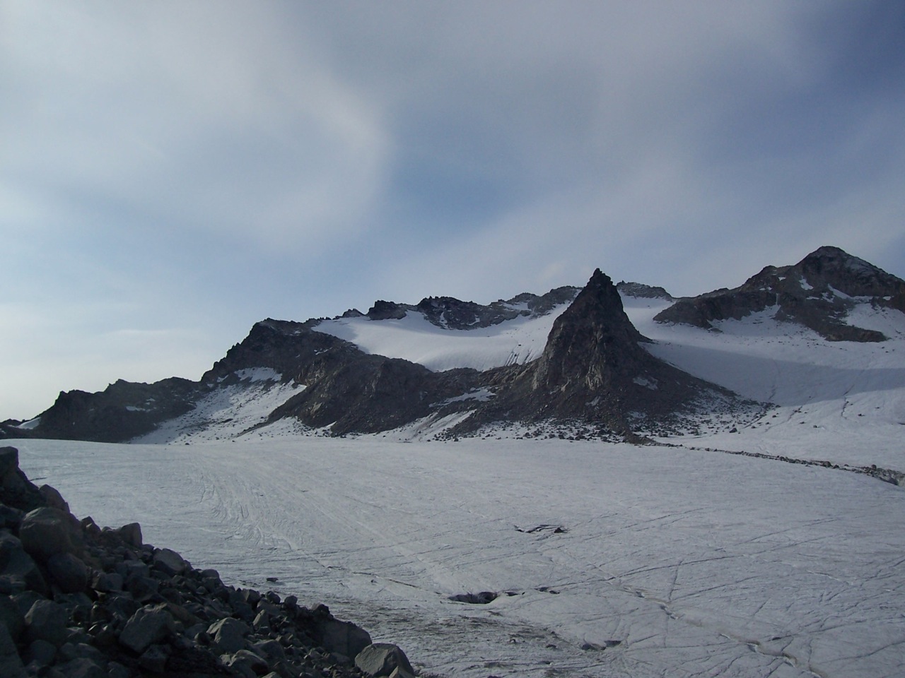
Some of the amazing sights along a eight mile stretch of the white rim.


I dropped my water bottle in this crack and had to go after it.
It's hard see the trail conditions in this pic, but is was great riding with very little sand due to recent rain.

Better look at that 8 mile stretch....
Panoramic of a section of the white rim.
My faithful steed gave the white rim hell not a single break down.Green River
The Candle Stick Tower


This was taken on top of murphy's hogback at 53 miles in the piont of no return both my quadracieps cramped and locked up on me. I honestly thought I was a sitting duck at this point because I was 25 miles from my car support, I had not crossed the hard scrable yet, and my legs where locking straight every time I stood up straight at this point. I changed my attack plan for the ride...Before mile 53, I was pedaling almost all the time and after hitting the mile 53 wall, I would pedal at an average speed of under 11 mph. It worked!!! My legs never broke down like that for the rest of the ride.


I have to give mad respect to Barstow on this one, he gave me beta on the trail from when he road it. He told me of things to look for and signs of my progress. I should be known that all Skier Boyz,' The Creep'n Catipillar, and a snowmaker talked a big game about going on this ride But when it came down to it there was only a lone old wasatch guy on the trail that day.
~El Borracho Loco

Sunday, November 6, 2011

Kenai Ski Weekend - November 5 and 6

Well, I ditched day 2 on the Alaska Snow Safety Conference to go backcountry skiing by myself. It was just too blue and there was plenty of low density fresh. I tore out of Rage City in cloud. I didn't bother to get the snow off my car; that's what highways are for. I had a Plan A, B, and C. Plan A was a long shot, but even with steeps odds, that horse came in.

I espied a skinner heading up Sunny Side at Turnagain Pass. It was an aggressive skinner but it was efficient. I ran into the group that set the skinner, and they were more than happy to share what conditions to expect up higher. They had kicked off a small wind slab off the SW aspect of Pt. 3340. I promised to keep my angles low.

Pt. 3340

About the time that I gained the ridge, the light went to shit. Oh well. I dropped into the low angle Triangle Bowl at the head of Seattle Creek. Even though the angle was low, the exposure from above was high. Avalanches had released in the prior 24 hours from either side leaving a mess of debris in the gut. I didn't linger.

While I was doing the mess around in Seattle Creek there was some action on the front side. A glide crack had fully released above the skinner taking out about 150' off switchbacks. Other than the nervous bile creeping up into to my mouth leaving an awful acrid taste, the skiing was excellent.

Dang ole' glide!

On Sunday morn, I responded to a flash mob request to Occupy Tenderfoot. Our caravan of 99%ers arrived well caffeinated and anxious to participate in a well thought out movement that is sure to bring about real change.

H★ Claiming Her Spot

KAZ and H★ formed our own mini group and sussed out some alternative areas to occupy. This led us to the north side of Tenderfoot Ridge. A+ snow accompanied our descent towards Butcher Creek. We returned back to Tenderfoot Ridge to reclaim our area, but by this point other protesters were congregating in our zone, but there was plenty of room for all.

The ground still hasn't frozen (3,500') and there was evidence off recent glide fractures in the area. A small wind slab had released on a micro feature (NW facing, 8", 10' wide, ran about 20').

H★ Occupyin'

- U.K.

Thursday, November 3, 2011

Peak 3000: November 2

Damn the daylight savings straight to Hell. Right now I can sneak out work a bit early and squeeze a nice 2,000' ski before darkness sets in. For some reason, this is all going to change on November 6. I figure without the change I could get another 2 weeks before Cosmo enveloped my after-work experience in darkness.

But today wasn't about November 6, it was about today. I love pushing myself hard, racing the sun, trying to strategize ways to save 30 seconds here, 20 seconds there: constantly peering back over my shoulder to check the progress of a cold indifferent star.

Blustery

Sunset over Cap'n Cook's Inlet

The snow felt hollow, so I didn't feel comfortable skinning under the top bowl. So in quest theoretically grounded in safety, but in reality the narrow rock lined gully looked like more fun. I pulled the skins before setting the booter because the wind was howling up higher.


Looking Down the Ascent

Neacolas (small) and Tortillas (large)

The skiing was nothing to write home about, mostly wind hammered with pockets of powder. C+ skiing but it was super fun to get in an after work ski in the daylight. Too bad it will be my last post work powder party in 2011.

-U.K.

Tuesday, November 1, 2011

Nor' Eastah

Every year hurricane (pronounced Hurr-ic-cin in by Utard's) and Nor' Eastah season rolls into the eastern seaboard, bringing with it, the yin and the yang. I'm sorry if I got you excited, we're not talking about the Yin Yang Twins (http://www.youtube.com/watch?v=aJEzl31zL-I). Not sure what those G's are up to these dayz?Fishermen associate these storms the monetary loss of equipment, ships, and death. The poor folk in New Orleans equate the word "hurricane" with the loss of their ward. No, no, not the LDS ward, like you're used to in the good ole' Beehive state silly. I'm talking about their entire community being destroyed by Hurricane Katrina! To no avail, those scumbags who rule the world, displaced these folks elsewhere, and built some mighty fine homes for those mighty fine rich folk down there in Na Orleanz. What an atrocity you say?


No surprise to me. I've known of the Dick Bass (Snowbird's 1%er owner) type and their agenda for a long time. A regard for humanity and the environment? Forget about it. The only thing that matters to this minuscule sect of the population is their bankroll. Pink Floyd was right, "Money is a Crime."
But without darkness, there would be no light. Without storms, there would be no surf or snow. Ya dig?

~Dick Dickerson

Wednesday, October 26, 2011

Ski Touring in the Wasatch

NW Col. Pfiefferhorn


Ten years ago, a man told me tales of getting off the chair lift at Alta and being up to your neck in powder snow. My mind tried to make sense of this....neck deep snow? How could that be possible I asked myself? My mind began to wander, but I could not imagine this "powder snow." It was akin to the human mind trying to conceptualise quantum mechanics.


Rippin' turns with SLC looming below


The following winter I hopped on an airplane in Boston, landed in SLC, took a shuttle, then a snowcat to my new home, a dorm room below Alf's Restaurant 9,240 ft, mid-mountain Alta, Utah. Greeted with 3 feet of fresh powder snow, my mind was blown. "Jumpin' Ja-hoe-sif-at," I exclaimed. Mt. Superior across the canyon from Alta Ski Area


When the storm cleared, I couldn't believe my eyes. Skiable mountains everywhere, covered in snow. The lone sets of ski tracks carved in fresh powder snow, scattered on the mountain faces across the canyon were inspiring pieces of art work. "Dude, its like Tuckerman's Ravine all ovah the place guy," I thought to myself. Ski track set down the fall line, not crossing another track, sheer beauty!


Louie's Rock


A bunch of other boyz up at Alf's Restaurant thought the same thing. We left confines of the resort and went in search of adventure and freedom. This became the regular and now nine years later I find myself skiing with many of those same boyz, The Skier Boyz.


~Richard Pumpington


Monday, October 24, 2011

Skier Boyz: PNW Chapter

For the past few summer's I have left the Beehive state in search of freedom and adventure. My passion for skiing Volcanoes landed me in the PNW. I work year round as a mountain guide and during "volcano season," I work for Timberline Mountain Guides and Smith Rock Climbing School, based out of Central Oregon. This allows me to partake in a plethora of adventures, such as climbing with Sniffles at Smith Rock State park.
The weather is fickle in the Northwet, but with patience and good timing, you can land some incredible corn skiing in pristine locations. Every Volcano has its own energy and scenic vista of the ring of fire. Pictured below is Nick Pope, fellow guide, and soon to be partner of mine in the Patrouille des Glaciers race in Switzerland in April 2012. Its a 3 man team race from Zermatt to Verbier, covering about 53k and 4000m climbing and 4000m descending. We will patrol the glaciers, roped together for safe glacier travel. Here Nick is about ski the east face of Mountain McLoughlin at 9,495 ft in Southern Oregon.
Mountain McLoughlin has desecents on all aspects of the compass. That day we skied 8000 vertical feet on the East, North, and South facing slopes. The Northely facing (pictured below) has the steepest and most BMFR (Big Mountain Free Rider) terrain on McLoughlin. Nick is new to the Skier Boyz organization, but he fits in well. He might be the fastest and most dialed person I've ever been with in the mountains. He is real nice guy to match, which is a must! Thus, I am excited for him to meet more of the Boyz and start shredding expeditions with us. Kazakhstan, Pakistan, etc....Dream BIG!!!
I am trying to ski off the summit of all the skiable Cascade Volcanoes(getting close!!!), but I spend most of my time here at Mountain Hood 11,249. As a guide in the PNW most of my employment is guiding people to the summit and back on Hood. Its "mechanicalized mountaineering," meaning we either take the chair lift up or use a snow cat to access the Wilderness Area and the summit of the great one. Below is Moon Beam, basking in glory in lot at Timberline Ski Resort, with the South Face and Wyeast face of Mountain Hood looming 5000 vertical feet above. When I'm lucky people hire me to go ski corn from the summit! This lucky fellah skied the Wyeast, West Crater Rim variation to the south side, and the Sunshine route in 2 days on Mountain Hood. If you look closely you can see the ski lift and cut trails. This picture was taken from the top of the Old Chute on the South facing side of Hood.
After taking the chair lift up to the top of the ski area at 9,500 ft, we hiked the last 2,700 vertical feet to the summit of Mountain Hood. From the summit you can drop north to the Sunshine route, which is a 4000 ft descent As you can see here Doug is enjoying the perfect corn on the snowdome portion of the Sunshine rt. On this day of Independence(July 4th), Doug and I skied some grade A corn down the 45ish degree upper section of the Sunshine route, between crevasses and above the bergschrund pictured below. I solo skied the route the week before and the shrund was about a 10 foot vertical drop and a 5 foot gap. A week later when we skied it, the shrund opened up and there was about a 20 foot drop. I set up a T slot, put in a picket, and lowered Doug over shrund. After Doug made it to safety, I thought to myself, what would Shreddy do? Thus, I yelled down to Doug to pull the rope. I cleaned the anchor, pointed my skis, and went airborn over the gaping hole. You can see my corn bomb-hole almost diretly above and to the right of Doug's ski pole.
Mountain Hood is home to many steep ski descents from the summit!

If this seems fun to you, you can hire me as a guide for some wicked ski descents here in the PNW during the spring or in the Wasatch range during the winter months for some powder skiing. Here are links to the companies I work for in Utah and Oregon.
Happy Turns!
~Todd Glew


Dog Sh*t Ridge: October 23

Conditions in the Summit / Turnagain area have remained mostly static since last week. Skins go on at 2,000' and the skiing gets good at 2,500'.

There were several large groups on Tincan on Sunday. There's a reason why this trailhead is so popular: the large variety of terrain and easy access. You can hit mellow bowls, pillow lines through the trees, drops big and small, steep faces, and even nordic terrain. And if you can't find a line that scares you going out past Tincan Proper, well buster, you're not looking very hard. There's evan a trail cut through the brush so access is good year round.

Chilkoot Trail Reenactment

We started in the rain and planned to get soaked, but as the day progressed conditions improved. Fog remained the valley but it was mostly sunny higher up.


Above the Fog

There was a heavy creamy layer on top. Snow was boot deep and it the turning was easy and by the end of the day, the Bowl was tracked out.

Winter on top of Fall

The valleys are awash in beautiful fall colors; warm and inviting. Up high, sun with calm conditions made for a wonderful day in the mountains. But the in-between can eat a bag of hot diapers. Hopefully Mother Nature will hit the reset button a few times this week so my Halloween costume can be "a guy getting face shots."

- U.K.

Wednesday, October 19, 2011

Mountain Silvertip: 10/18

Just what the Hell is Alaska Day? I wasn't sure, but it was a day off from work. I figured in the absence of structured holiday events, that the best bet would be to treat it like MLK Day.

I loaded the skis and put Anchorage in the rearview. It was cloudy, but forecast called for clearing. The goal was Silvertip. Skiable snow in Summit / Turnagain is at about 1,800'. The Silvertip trailhead is at 600'; there'd be some walking.

There is a gated mining road that gets you through the worst of the brush. Unfortunately, I convinced myself that this was the wrong road and tore off into the woods like an idiot trying to find the "correct" road. 90 minutes later I popped out a ½ mile up the original road. Moron! At least I was back on route. The road quickly peters out into ATV trail and then a small path that puts you at a perennial snow-bridge. Using this and other bridges, you can link meadows on either side of the creek.


Very Convenient

Silvertip Creek splits around the NE Ridge of the peak. I opted to make for the ridge from the mini-confluence. This involved some steep bushwhacking and creative swearing. Progress was slow but eventually I gained the ridge at about 2,000' and immediately started skinning.

The snow was refrozen slush and odds for soft conditions up higher seemed low. Despite expectations, the snow quality drastically improved at 2,500.' A few new inches made for easy travel.

Looking Back towards the Trailhead

Now was the opportunity to make up time that was lost to pointless alder smashing. The NE ridge is low enough angle to avoid any switchbacks, but this makes for a long (albeit safer) approach. The wind kicked up into the 30 mph range around 3,000' and with those few inches available for transport, it was full-on winter.

The Final Push to the Summit

The last 600' vert gets steeper, but fortunately wind had scoured the ridge down to only a few inches giving me that false sense of security that I am so fond of. The views from the summit are outstanding. Silvertip looks down 6-Mile all the way to Indian. Both Summit Lakes are in your lap as is all of Turnagain Pass.

The Ridges of Turnagain County

I quickly transitioned using an advanced technique for folding skins in high winds. Now: to the schuss!!! The ridge held no appeal. The SE Face has been taunting me for years. Today would be the day.

The Top 1,300'

There was a slight wind crust for the 1st few turns, but conditions improved dramatically. The snow wanted to be my friend and with gravity as my weapon, I let 'em run!! Yelps and whoops echoed off the steep walls in front of me. Wind whipped and snow flew and before too long I had descended 2,500' to the creek.

I stayed skier's right of the creek and was able towork the snow down to 1,500.' Once on foot, I linked meadows with minimal shwack'n by staying boater's right. The friendly neighborhood snow-bridges continued to play an important role and I was quickly back on the the mining road heading for home.

Hint: Stay on the mining road for a optimal travel.

- Michael Schultz


Monday, October 17, 2011

Tenderfoot Ridge: 10/16

Sign no more: ski season has arrived on the Kenai Peninsula. Yes, I know people have been skiing Turnagain since late September, but the approaches are diminishing as the snow line slowly creeps towards the roadside.

Our rather large group converged on the Tenderfoot Campground between the Summit Lakes. Despite the lack of snow in the car-park, the approach to Tenderfoot Ridge is benign thanks to some early ski entrepreneurs. Trails cut in the 50's for Summit Lake Ski Hill make for a bush-whack-free climb.
From the Bottom of Summit Lake Ski Hill

Skins went on 400' above the lake. Snow pack grew quickly throughout the ascent (≈24" between 3,000' and 4,000'). Tenderfoot Ridge is a series of false summits tempting you higher and higher. Just 5 mores minutes and we'll top out. Nope! Try again and......... denied.

Not the Top

Numerous glide cracks had opened on steeper slopes with many reaching Butcher and Tenderfoot Creeks. We elected to schuss the mellower slopes of the "front side". Snow was falling but not fast enough to obscure tracks between runs.

The Wise Owl Contemplates another False Summit

Skiing was good and there are enough trees on Tenderfoot to keep the vertigo at bay on those rare flat light days. High density creamy goodness kept the team on top.

Occupy Freshies
- Emmet Otter

Friday, October 14, 2011

the skierboyz and girls are getting anixous for winter so they have gone dirt shredding

notice the old lake bonniville shore line ,oh how wish it would come back. May be the boyz should dam up the snake river and send it down here so they beat uncle keith in snow fall .Idaho won't be mad all they like is potato's and meth.
part of the huge lake that will help us reach a record breaking 900 inches this year and make the skierboyz very happy
grear tower of Mordor
the end of the line
some of the skierboyz shredding the dirt

Sunday, September 25, 2011

Jewel Glacier (9/23) & Snowbird Glacier (9/25)

The Jewel Glacier was surprisingly good on Friday morning. 12-18" of fresh blanketed the upper glacier and summit zone (4,800') with continuous skiing down to 3,900'. There was a crust, but after shaking off the rust, that mean-old crust didn't seem that bad. The Jewel is split into 2 halves these days and I worked the high rollover on the skiers' left.

The Rollover

Milk Glacier from Mountain Jewel

The Snowbird does not have the coverage that the Jewel is enjoying, not by a long shot. The Snowbird is currently boasting trace to 1" of new. And that 1" is very angry. Actually above 5,500' there is some old snow below the angry inch, which made for a pleasurable turning experience.

On a positive note: the new Snowbird is complete and it is sweet. 10 folk shared the hut Saturday night and there was ample bunk space and a seat at the table for all. The heater runs on diesel so be sure to bring some fuel for a toasty night. Heather hiked in some fuel in an old gallon white gas jug.

The former "Nunatak" from the Hut

Bill Crawling towards the Deep

Tuesday, September 6, 2011

ADK New Slide Alert!

With all the destruction to the East Coast by Tropical Storm Irene it may be hard for anyone to see a possible positive side to the storm. But, the following photos are a testament to one possible positive side effect... New or improved slides in the High Peaks Region! Jeff 'Sensei' Murray, a close friend and great ski partner, offered to take me up in his plane and survey what the 'damage' to the peaks was.


Yes thats right! A western style chute right here in NY! The Trap Dyke, on Mt Colden, has for years been an East Coast winter mountaineering objective. In recent years it has been getting skied with a rappel over a steep icy section towards the bottom. It looks like now, after Irene, that steep section may be filled in enough to ski without the rappel and the new slide directly from the summit into the chute looks to makes skiing from the true summit that much better!


This is Ottis Gully, on Mt Colden also. It has been getting skied for years as well. The difference is now, post Irene, that the gully got scrapped clean and the runout at the bottom appears to go right to the trail! No more bushwhacking to get to/from it!


The slides on the left are the Angel Slides on Wright Peak. The new slide to the right; as of now is unnamed, as far as I know. Besides an entirely new slide to ski this winter, the big difference here is also the approach. From the lake in the lower right corner to the Angel Slides was about a 1/2 hr. You can see how much closer the new slide comes to the lake. It appears to cut the approach time by at least a 1/3!


There were 3 other new/improved slides of skiing significance but I did not get good photos of them. Check out Drew Haas's site at www.adkbcski.com for photos. The ones to check out are the slide on the North face of the Wolfjaw's, the slide on the South Face of Upper Wolfjaw and the slide on the North East face of Saddleback. These all appear to have easy/improved access and look like a ton of fun to ride!


So I know that winter for most of the boyz usually starts in the next 2 months. Well here in NY we have a little bit longer to wait but this year we have some new terrain to explore when it does finally happen!


-The Dude


Thursday, September 1, 2011

SE Wall of Tanner's Gulch: February 17, 2004

February 17 was ordained to be a throw-away day. We were in the tail end of a massive inversion. Baldy had been open for 5 days, Alta was bump city, and the obvious back country lines had long since been tracked out. The inversion was showing signs of weakness; snow was on the way, but the 17th was to be the transition. Flat light, wind, trace - 1": a day most chose to sit out and patiently wait for the next storm.

Well, I've never been one to waste a day when the stability is good and I knew a few like thinking individuals. Gremmie, Pow, the PA Prince, and I met at the cat shop before dawn with Coalpit dreams, but clouds had obscured the top of North Thunder. So it was on to Plan B: check out the Pearls, but there was not enough snow at that low elevation. I had one more idea: Plan C would be Maybird Couloir. The big walls would help with the flat light and my personal buffalo herd would set the booter.

The team set off in high spirits which quickly descended into skepticism. The west facing aspect above the chute had dump tons of manky snow into the gut of Maybird over the prior week. Of course this had consolidated into roughly 1,000' of frozen basketballs. Despite this omen, we continued upward. Eventually Maybird Chute transitions into a ridge the continues onto Sunrise Peak. About 400' below the summit, it was time to assess the situation. We had three options; none were super appealing.
  1. Ski back into the Maybird frozen wet slide mess
  2. Drop blindly off towards Lisa Falls
  3. Drop blindly off towards Tanner's
Based solely on the location of the vehicle, Plan D would be the Tanner's side. This line is highly visible from upper LCC and it is true a classic. You get a great view coming across the EBT, from Eddie's, and at the top of the Tram. Right there in plain sight, but it is often overlooked. Hell, I had never even registered it as a ski decent in my 5 seasons as an Alta employee and thus never paid it no mind.

SW Wall Tanner's
(taken at a much later date)

Gremmie dropped in blind at a weakness in the humungo cornice (where the ridge doglegs slightly and becomes illuminated). Success was not guaranteed. We'd stop often and deliberate and hem and haw. We snaked back and forth over small spines and linked small batches of turns where possible. The skiing was not overly difficult but the unknown factor coupled with obvious deadly exposure made for slow deliberate schussing. The snow started fantastic but transformed into an ever thickening crust. There was no idle chatter; it was tense.

The expanse up high had shrunk into a tight winding funnel. There were 2 distinct cruxes, the 2nd (easier) crux was documented. In the funnel, my preffered style was the controlled jump turn. Sloughs from each turn fell away down the fall line cascading over cliffs. The funnel pinched. Gremmie dropped the knee and made it look like Mambo. I down climbed through scrub trees and hollow chalk snow with skis on as the pitch approached 55°. I was having a not-so-flattering conversation with myself regarding my decision making skills. Against odds I had made it. Now the real heart burn began as I watched Pow and the Prince enter into the funnel, but they made it look easy. I soothed my ego by philosophizing that they were able to steal my sweet moves via careful observation.

The team regrouped. What lay before us was a wide 40° gully rolling gracefully into the bottom half the standard Tanner's route. Success!! Despite our complete lack of preparation we were into familiar terrain, and 1 hour after Gremmie made his first tentative ski cuts, we hit pavement.


Once back in the safe confines of Alta, I was able to study this shot. So big and obvious. Most lines in Upper LCC look incredibly difficult, but this is usually an optical illusion. Suicide, the summit pyramid of the Pfiefferhorn, Superior, and even parts of Eagle's Nest come to mind. But this is not the case with the SE Wall of Tanner's. What you see it what you get. Tense, puckering, unrelenting with so many close-outs. So many ways that don't go. But with the help of an unseen hand, we somehow had made it through.

- U.K.