Tuesday, December 21, 2010

Winter Solstice

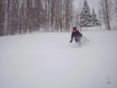
True winters first storm hit hard as it made its way to SLC and the Wasatch mountains from the pacific. This storm dumped epic amounts of snow in Mammoth and across to the wasatch it continued. We are gonna exceed six feet in four days. The temperature won't stay at a constant cold so our snow level has been going up. Skiing has been dreamy! Before the big one arrived we had Green light conditions and a fresh coat. It didn't last too long and onto the low angle we play.This is a classic shot of a skier boy Adam Lawton setting the booter up the exposed East ridge of Superior. We opened the S Face at the crack of noon. The snow was sluffy and beautifully soft just wish the visibilty was as clearer.
Skier on the lower shot of N chute on Lake Peak in White Pine. We ascended this way and skied the more E chute from the summit.
Chris fish dropping in to the NE chute avoiding any rock lobsters. It was a beautiful day in White Pine. The last blue sky day before it began to puke.
This was our clan for the day. After Lake Peak we went across to the Tri chutes and Birthday bowls to ski some more deep pow under blue bird skies. An unfortunate party attempted to race Todd to the top and had to settle for the right Tri chute as they watched Todd snake the cherry pickings.
Celebrating the coming of winter in White Pine!

Chris fish and I skied the big N aspect into the Birthday bowl and Todd and Stefan came back up the ridge to enjoy the lower one lookers right.
Fraser and Olivia drove up from Ridgeway, CO to ski this storm. Some gusty winds weren't gonna stop them from having a taste test.
"Its definetly drier and deeper than Co" Fraser adds after a sampling in Willow meadow.
Matoosh Matook taking in what the Wapan has to offer on high danger days.
Bouncing Beattie enjoying every day he gets out.

Saturday, December 18, 2010

Tri-Tip to Tenderfoot: December 18

It hasn't snowed all week which means Turnagain is bumped out. Summit hasn't let me down all year and today was no different. There was a huge wind event in town this week and I was concerned about the snow quality down south. This concern turned out to be unfounded. There hasn't been a whisper of wind all week. Our tracks from last week were still visible. Cold, clear, calm: Summit has been turned into a facet factory. Good news for today, but bad news after the next storm.

The skinner was still in great shape from last week despite some rouge snow-shoer's (Palin?) attempt to destroy it. We gained the summit of Tri-Tip 1 (of 3) and continued east to a sneaky pocket couloir.

Hubert Leading the Charge

The couloir faces north and peaks in the low 40's with a nice run-out high in the Tenderfoot Creek drainage. There was about 6" of recycled powder on a hard crust. Turning was loud, but conditions rapidly improved throughout the 1,800' descent.

Looking Back up the "Pocket Couloir"
(click for a better view)

H led the charge again this time to Tenderfoot Ridge. Before long we were relaxing up high, chowing down, enjoying some "adult" coffee, and basking in the sun. December 19th only has 5 hours, 28 minutes of sun up. It rises and sets in the south and only gets 6° above the horizon. This factoid played no role in our selection of our 2nd north-facing couloir of the day. This one started much rougher, but true to form, rapidly improved as we descended to Butcher Creek.

Daylight was running short, so we opted to to call it a day instead of looking for a 3rd north facing shot. The run back to the lake rewarded us with a couple of miles of high quality low angle love.

Sunset over Summit Lake III

One of about 20 Moon Rises / Moon Sets on the Drive Back to A-Rage

Summit gets high marks again, but the next storm will be interesting to say the least. For now, the workers at the facet factory are putting in some serious overtime.

-Banksy

Friday, December 17, 2010


sorry skier boyz I have been out of the loop not touring to much do to these snowmaking nights .The good news is im done and have earn my alta pass after friday and will be getting back in the backcountry in a major way.Here are some pics from the 2010 SM season


Saturday, December 11, 2010

Tri-Tip: December 11

Summit continues to deliver. Today Hubert and I decided Tri-Tip would be a the way to go. Summit Lake is now frozen allowing us to short-cut over the ice. This saved about 20 minutes. As usual, H set the skinner from the vehicle to the top. There were some class 4 and 4+ moves, no class 5 this time. After 90 minutes and 3,000 vert I reached the top to find Hubert well rested.

The light was better on South facing, but South facing has been variable in Summit lately, so we opted for the big West Bowl. Good choice. The snow is about 12" deep over the dreaded Thanksgiving Rain Crust. This was enough to make for some quiet schussing.

It was good, and the skies were clearing. So there was really no choice. Back up and near the top we gained the sun. Our line was bathed in a soft pink hue. There wasn't time to linger so back to the lake.

Hubert Catching the Fading Light

Sunset Over Summit Lake


3,000' Vertical from Summit to Lake (Skied Lookers' Right)

Getting to Tri-Tip
Park at the 1st pullout next to Upper Summit Lake (mile 47.5-ish on the Seward Highway)
Cross the lake and head on up
From the top of Tri-Tip there are North, South, and West shots
Choose wisely
Ski it

- The Kingpin

Wednesday, December 8, 2010

Manitoba: December 5

We've all seen storms hyped. The hype is big. It's gonna dump. It's gonna be epic. It's gonna be this. It's gonna be that. But when dawn breaks, what is the reality? More likely than not, the hype does not live up to reality. Hype sets the bar high and unless its met, you will be disappointed. Hype will turn 12" into a let down. Hype cannot help; it can only hurt. Without hype, there cannot be disappointment.

What made this storm different was that the hype of the storm carried over into the avi forecast. The storm fizzled, but the forecast refused to accept the 3" reality.

So I met some friends and headed for some lower angle terrain. Manitoba has a super-wide 30° South face and some impressive North facing couloirs off the summit. Its perfect for a day when you are unsure of the stability. It was bluebird with about 8" (2 storms worth) of blower with no wind. Stability tests revealed nothing of concern, but the 1/2" hoar frost could make the next storm interesting. The skiing was excellent and the team felt more comfortable on the South Face. Our final lap was bathed in the alpenglow which was really lighting up the hoar frost.

The Summit area has been blowing my socks off lately. The terrain is much bigger than Turnagain and way less people. Everyday puts about 10 new lines on the wish list.


South Face of Manitoba


South Face of Silver Tip
Dresden II: Back to the Projects

Sunset over Summit Lake

To get to Manitoba park at the Mile 48 lot on the East side of the Seward Highway. Skin North along the highway for about 100 yards and follow the fire road into the woods and over the bridge.

- Daniel Elsberg

Saturday, December 4, 2010

How to Read an Avalanche Forercast

Well its time to slaughter this sacred cow.

First off, the forecasters are extremely smart people with a difficult job. They have more snow safety training than most. There is good info in every report but you need to know how to find it.

The first thing a person needs to ask when writing any report is: "Who is my target audience?" Most people in the backcountry have no snow safety training and more and more of them can't ski for shit. This is the target audience. These are the folks that need take the forecast literally. They do not possess the tools to make good decisions so the forecasters make a conservative decision for them. The targeted people are not bad folks, in fact we've all been there. The report is designed to scare these people.

If you are in this category, read the report like its gospel and you are a fundamental Republican. 40 days. Copy. Adam's rib. Roger. Considerable. Repent! Repent!

OK, you have some training. You've get out multiple times each week. You've conducted stability tests. You've got a network of buddies out there everyday feeding you beta. Do you need to read the report? Absolutely! The reports have good info, but so do you're other sources. Developing a forecast for an entire range is tricky business. Every nook of that range is slightly different. Don't discount your specific knowledge about your specific nook. The forecast is not specific.

The forecasts are written in shades of grey, and it gets more so every year. Gone are the days of "today is the day to check that big line off your list." More and more its "isolated pockets of instability." Cover your ass, pure and simple. If you always leave the possibility of avalanches, you can never be wrong.

Despite the vagueness of the language and the impossible task of developing a range-wide forecast, there is never any ambiguity when there is an incident. That is black and white. It becomes a morality play about good (the center) versus evil (you). It is meant to make the person involved in the incident look like an idiot. You will be compared to that Led Zeppelin guy in the rain. This technique helps to keep the target audience in fear and in awe of their power.

They roar down from the summit of Mount Olympus: "See what happened when people do not obey our (vague) will! You will be destroyed! Feel my wrath!" This technique is very effective in scaring the masses, but it has an unintended consequence. Many incidents don't get reported. This is where your network comes in handy.

They only deviate from the playbook if it a forecaster involved. Then it is described as "a very experienced" blah, blah, blah.

The bottom line:
- Read the forecast everyday; its an important piece of the puzzle
- Take it literally if you have limited training/experience
- Be prepared to have any incident you are involved in to be twisted to make you look dumb
- Remember, there are days you should rally the resort

Hector 3

P.S. The resort was a blast today


Wednesday, December 1, 2010

SNovember

October 25th was the date that it started snowing in the Wasatch. It was a skier boy'z 29th Birthday and he was excited to begin the ski season. This year it didn't warm up like it usually does after the first snowfall. Almost 150 inches by Dec. 1st!!!
Gotta take your birthday shot before you get your face shots.
Oct. 26- Opening the season on So Long, Alta.
After summiting Sunset Peak Dan Corn dips deep into its classy NW face.Back on the rock, LCC.
Dillan and Brett back on top feeling good about the white Wasatch's return.
Lawton sending Upper Days.
Brett dropping into the Upper Hallway. Looks like hes done this one before.
Crossman can't believe he's skiing Suicide chute this early and this good!!
Some thought he wouldn't be back this season, but I got to tour with the Wiggler during a bi-canyon tour last week. We found the goods.
For Thanksgiving I went down to Red Rock Canyon to take one last climbing trip with Gaelen. We got shut down pretty hard due to cold weather and some snow. This is a picture of Black Velvet canyon where we attempted Prince of Darkness, but retreated two pitches up.
Windy Peak had sun exposure all day, but we got shut down again because of the cold temps.
Gaelens last climb of the season. Have fun and be safe in Thailand, see you in April.

Kid Buffalo

Saturday, November 27, 2010

sunset helmet cam

pilot and index peak outside cooke city MT the boyz need to ski these peaks there rugged raw stefan sending a cascade off one of the sky ramps

same sky ramp before it was skied


here is some helmet cam clips for the boyz I have a bunch more that still need editting

Friday, November 26, 2010

Beacon Reviews

I came across this website that has reviews of avalanche beacons past and present. Useful info.

http://beaconreviews.com/transceivers/Specifications.asp

Tuesday, November 23, 2010

Time Machine: January 1, 2005

Definitely missing those deep storm days rolling with the Boyz. This day stands out in my mind.

"The Prophet"


What's up with that loose heel?

Thank You Uncle Keith

Adam, Slody, and Todd opened this roadside attraction in BCC today.
Wish you were here Prez. Winter is here and we wish you were as well.

We Miss Our President In The Wasatch.

I'm sure like he misses days like this. We miss having the prez in our back yard.
As he opens more runs in the wild and I remember the Quote "North to the Future." and try to plan tripps into America's Last Frontier. We all miss you here!!!

Saturday, November 20, 2010

North Bowl and Peak 4940: November 20

"Do the Right Thing" had just finished up. Mookie obviously didn't do the right thing, but can his actions be justified? The MLK quote says no but the Malcolm X quote leaves room for interpretation. Obviously Mookie could have prevented the shit-show, but does yelling "hate" absolve him? White people get to ski on Dr. King's B-day so I'm going with his theories. Oh, I get it; the movie is spoda make you think. 2 stars. I hope Netflix doesn't start recommending racist movies. Ring, ring.


It's Bass. Parental obligations have limited his free time and at 10:30 PM he has a small window between feedings. The moon was full, the night was clear, and it was his B-day. "I'll pick you up in 20, Dave." We headed to Hiland Road in Eagle River and parked at the State Park trailhead and were skinning by 11:30 PM. It brought back memories of Alfie's. Where were the cats? Oh, that's right; shift change at midnight.


We topped out around 12:30 AM and Anchorage was twinkling below. Dave dropped in and I followed. The snow was excellent, but the base was lacking. The moon was bright, but not bright enough to pick out the rocks. Another foot or so, and Eagle River will be much more fun.


Anchorage


When you wake up in AK in November and it's light, you screwed up: daylight is extremely limited. Darn! Shoot! Dag! After a quick RBGC I was speeding South to Turnagain Pass. Fog on the inlet, bluebird up high. The Turnagain Pass user area is split in two: east is non-motorized, west is snow-machine friendly. Currently, there is not enough snow at road level to accommodate our motorized friends. This would be a good opportunity to check out the west.


I parked at the gated entrance to Granite Creek just South of the Johnson Pass trail head. I espied a skinner heading up the non-motorized side. Perfect. I was expecting 2,500' vert. Why? Don't know. Ignorance, stupidity, callousness, fever? Probably some sort of combo. 4,300' later I topped out. Holy moly! I compared my elevation to other peaks in the area that I was familiar with. How had I missed Peak 4940? This is the highest peak at Turnagain and it has 3 sides of 4,000'+ continuous skiing. The west side brings you into a massive bowl and chute system that goes straight down to the road, but I couldn't see the middle section. East would get you back down into the Turnagain Pass area near Bertha Creek. Heading south would keep me in the light and retrace the ascent. I wanted the west side, but I was alone and daylight could end up being a factor. So I choose south.


The Bottom 2/3 (Ascent via the Gully on the Right)


Looking Down the Pass towards the Turnagain Arm


Entering the Couloir


The snow was variable. The top was carvy styrofoam, great for carrying speed and arcing turns. Eventually it was time to enter the couloir. There were still some pockets of recycled powder hiding in the nooks, but mostly it was supportable crust and frozen roller balls. The runout was pretty good too. I came across this area by accident and really had a fun day of exploring, but when I return it will be no mistake. I want the west!


- Gerald "Coop" Cooperberg

Naming Update:
I was skiing the TT43 (Terrain Trap 43) area. The State refers to the South gully that I ascended as "Slide Path 4.3." See Plate 3.

http://dggs.alaska.gov/pubs/id/2255

Avalanche Mapping refers to this as "62 Mile".
http://www.avalanchemapping.org/Avatlas.htm

There is some confusion as to what exactly TT43 refers to. It may refer to the South Face that I ascended/descended (Slide Path 4.3 / 62 Mile). It could refer to the West bowl /couloir system that starts at the summit of Peak 4940. The West Bowl area is definitely the most aesthetic ski run off of Peak 4940, and since this slide path does not impact the road, the state hasn't given it a name (a far as I can tell).

It anyone can clear this up, please leave a comment.

Thanks.

Sunday, November 14, 2010

The Skier Boyz Moto


Not much going on here. But I've been following the moto.....SUSSIN' LINES AND SLAYIN' DRAGONS

Friday, November 12, 2010

Hiland Road, November 11

The Wind Advisery forecast for Turnagain Pass had me thinking about other options. Normally Hatcher Pass would be the answer, but it has forgoten to snow there so far this year. I was hearing good things about Hiland Road in Eagle River and decided to check it out.

There's a perfect plowed pull-out in the runout of a 1,300' couloir on the NE side of the road. There was about 8" of snow at the pull-out (2,000'), but conditions improved rapidily above 2,800'. The couloir eventually tops out on a ridge and continues up to a peak (~4,600') 1 mile NW of Harp Mountain.

Pit Results: NW aspect, 35°, 3,500', Mostly cloudy, wind out of the East
Depth: 59 cm
CT 28 Q2 at 31cm

The snow looked excellent and the light decided to cooperate. Unfortunately there are thousands of sharks lurking just below the surface. Plink, plink. There just isn't enough base at Hiland to let 'em run. Skiers' left in the couloir was better; it was loaded with about 3' of wind blown cream. The bottom 800' was slow and stressful due to the lack of base at this elevation.


Looking SW into the State Park


Top of 3 Bowls

Monday, November 8, 2010

Turnagain: November 6-7

Just a quick update on snow conditions at Turnagain.

As of Sunday afternoon. there was 24" in the meadow near the Tincan pull-out. I dug 3 pits on Tincan at 2,000', 2,200', and 2,900'. Depth ranged from 60" to 65". Snow was generally heavy and wet with conditions improving dramatically above 2,500'.

On Saturday I got a CT20-Q3 at 2' down. I couldn't get this (or any other) layer to fail on Sunday. Despite varying densities in the snowpack, the snow from last week appears to be acting as a cohesive slab. There is 3-5" of old snow at ground level. This snow has gone through some melt / freeze and is cohesive. The new snow bonded well to this layer.

There were some sloughs on steeper rollovers from snow that fell early Saturday. Terrain features such as roll overs and small drops that will be buried later in the season exist everywhere.

It looks like full on winter up high, but beware of numerous shark fins lurking just below the surface.

Monday, November 1, 2010

Snowbird Glacier: October 30-31

The report said they had groomed the Nordic area at Hatcher Pass. I assumed that this meant there was enough snow to ski and made the drive up to the Talkeetna Mountains with plans to suss out the new Snowbird Hut.

There was only about 2" of snow at the turn-off for Archangel Road and I was surprised to see that the gate was still open. I started hiking from the Reed Lakes Trail Head. After about 1.5 miles you come to a dilapidated cabin. Here you turn left and begin the 2500' climb to the pass. There wasn't enough snow to skin but enough to make every step a surprise. There was 18" of snow at the pass; more than enough to ski this glacier.

The American Alpine Club built a brand new hut with donations and volunteer labor. I attended a kegger/fundraiser in the Fall and knew I had to see it for myself. The hut is perched on the lateral moraine on the skiers' right. The old hut is still in place and is usable for this winter. There are plans to remove it next summer.

The Huts

View from the New Hut

New Kitchen


New Bunks


There is plenty of gear stashed in the hut. No need for a sleeping pad or a stove. There are nice well-used sleeping bags and booties, but I was glad that I had my own. The cook stove runs on white gas and the heater runs on diesel/kerosene.

After getting situated in the Hut, it was time to kick off my 36th consecutive month/36th season. The glacier is really a wide ass "blue square" run, but starts getting steep as you approach the 6,000' ridge. I wanted to gain the ridge to see if it was possible to link up with the Lane Glacier for a potentially easier way back to the car. The route was marked with small crevasses so I opted to stay close to the rocks. I couldn't tell if I was on glacier, solid ground, or hanging out over the moat. Pole probing revealed that there was solid ground/ice under me and I turned my attention to snow stability.

There is 36" with 1/4" surface crust at all elevations/aspects with hoar frost developing. From a safe spot, I stomped the snow with a ski. Whooooph. Shooting cracks and sympathetic cracks 15-20' below me. Steeps are touchy. Copy.

From my aerie, I de-skinned at got the Hell out of there; back to the hut, back to the beer.

The next day I got in some nice low angle love. The crust was catching the wind and attacking my face. The skiing was decent, but the scenery was amazing. Thanks to all the volunteers and donors for providing such a comfortable place in this spectacular location.

-GOB