Thursday, December 20, 2012

December in AK: Deep Winter

The are 5 seasons in Alaska, and we are currently in Deep Winter which is oft confused with Regular Winter, but they are quite different. Deep Winter is eeriely similar to beyond the wall in the "Game of Thrones". Deep Winter has a unique mood and feel that makes one long for the salad days of Regular Winter. Deep Winter grabs hold in mid-November and hangs on until the merciful release into Regular Winter in late January. 

Tommorow marks the celestial mid-point of Deep Winter. The sun will rise at 10:14 AM and set at 3:41 PM for about 5.5 hours of daylight, but this is misleading.  The real kicker is that the sun only gets 23° above the horizon. When the sun is up, it is low in the sky and produces similar intensity as you'd expect just after dawn. Sure, it's nice, but it does not warm. During the brief daylight hours, the city is covered in perpetual long shadows cast by buildings. Entire neighborhoods and some towns (Girdwood) receive no direct light for months.

Our pathetic Northern star leaves the streets covered in ice and packed snow; there just isn't the oomph to kick start any melting. Overnight frosts stay on parked cars day after day, just getting thicker and thicker. Deep Winter brings the coldest temperatures of the year. This week's low at my place was -17°F.  This morning's temp was +14°F for my ride into work and I swear I could feel the warmth in the air, that is until the wind kicked up. 

Hunk of Junk Pathetic Excuse for a Star

It is truly a relief when Deep Winter finally yields to Regular Winter.  The sun regains its ability to warm. Icicles begin to form on trees. Snow begins to melt off of parked cars and the glazed roads slowly give way to pavement. February brings those pleasant winter days that I loved so much growing up in New England and bumming at Alta.  Full days of skiing in the sun, a sun that will warm your face as sit down and actually relax on a ridge.  The sun that warms the late afternoon air and makes for a pleasent transition into driving clothes after a day in the backcountry. In just a few short months I will be able to leisurely sip a beer at the trailhead with the car doors open and the radio blasting while my ski boots effortlessly slip off.

This winter has been tougher than most.  Long stretches of below zero weather coupled with a serious lack of snow have made motivation a rare commodity. The weather pattern so far has been the perfect advertisement for Fat Bikes. Cold temps and scarce snow have at least doubled the moutain bike terrain around Anchorage. Swamps and lakes are now set up perfectly for this method of travel. Muddy trails are frozen solid and the bears are asleep.

The Noodler on the Middle Fork Loop
(photo by Eric)

On the Sunny Side of Campbell Creek Canyon
(photo by Eric)
There is more snow at Turnagain and Hatcher Pass but the long stretches of cold and clear have made for uninspiring alpine skiing. It is always fun to get out and tour around, but it currently leaves much to be desired. The highlight for recent outings is finding a nice aerie in the sun and basking in the sun's faded glory.

Snow Beach
Home runs back to the car are always after sunset. The vehicle is frozen solid and it fights the starter. You wrestle your frozen, stiff boots off your cold sweaty feet and quickly take shelter in the car.  The heater blasts an icy wind. You put on your "car-puffy" and shiver and as you choke down your almost-frozen "celebratory" beer and relive the day's highlights.

Sorry, Taco, but we're driving now despite your cold oil and stiff clutch.


So far its been the winter for ice climbers, fat-bikers, and skaters. Although these activities are super fun diversions, they are just that: diversions.  Diversions until a weather change can facilitate my passion. The weather change will come, sooner or later and until then I will find distractions wherever I can.

 - U.K.

Friday, December 7, 2012

12 Days of Christmas

On the 12th day of Christmas, my true love gave to me....

12 inches of base,


11 Horsemen Blowing,


10 sparkle toes,


9 bucks off a day pass,

8 skis in a bonfire,

7 centimeter depth hoar,


6 weather guessers guessing,

5 feet forecast,


4 Facebookers proactively bragging,

3 storms lined up,

2 bad it won't happen,

And an angry inch on ice moguls.

Merry Christmas

Tuesday, November 27, 2012

Late November Update: Alaska

South Central Alaska had the wettest Fall on record and everyone expected this moisture pattern to continue into the winter, which starts up here in the middle of October. Unfortunately for the skiers, Mama Natura had other plans. A huge high pressure has been sitting over AK for the better part of 2 months.  There have been a few some drive-by storms, but 6"/pop separated by 7+ days does not build the base. 

Between storms it has been cold and clear: great for our Northern version of the Aurora Australis, but bad news for the snowpack.  There was a glimmer of hope when a warm front pushed through with some rain and warm temps and for a brief window facets were going to rounds.  But since this, it has been a steady march to square powder that will not consolidate. 

Thus, I was left with two options: bitch about the snow or find something else to do.  Now don't get me wrong - I love me some good bitch sessions, but I'd rather get out and do something.


Thin Snowpack at Turnagain Pass
Skiing
The skiing has been good, but it is still early season conditions which has a higher potential for injury. It's not the rock you hit; it's the rock you land on. I've been going out every so often to check on the snow: see what it's been up to and find out how it's feeling. It's been cranky.

Self Improvement
My medical training has always been an area that has been severely deficient, severely. I was fortunate to take a heavily subsidized WFR class this month. It was an awesome class and now with my card, I shake my head in disdain at the outdoors men and women that have neglected this personal responsibility. 

Getting Out of Town
Road tripping in AK does not get you to a big city or a warm desert or even to a different weather pattern.  Generally, it's more of the same.  So many Alaskans take their PFD kickback and hand it over to the airlines for a brief respite in Hawai'i. 

The Dragon's Nostrils: Blowholes near Makapu'u Point

Kiliouou Ridge Trail and East Shore
Nordic
It pains me to say it, but the Nordic skiing has been pretty good. The trails in Anchorage are still in poor shape, but the cold temps have frozen the lakes solid. Going around a flat lake can get pretty boring unless there is a glacier that calves into that lake. So we head South to Portage which is situated in the valley that divides the mainland from the Kenia Peninsula: Chugach on the left and the Kenia Mountains (Turnagain Pass, etc.) on the right.

There is about a foot of snow in the Portage Valley and signs of Nordic activity are everywhere. Tracks lead in and out of the woods and up the 20-Mile Drainage. There's not enough snow for the snow-machines, so enjoy the tranquility while it lasts. Today's destination is the Portage Glacier

Sheep Kicking Rocks onto the Highway

Portage Valley
The state built a visitor's center in 1986 with excellent views of the face of the glacier; however, the glacier promptly receded around the corner and out of site. The visitor center is closed in the winter, but the car park is still plowed. We followed the established track on Portage Lake towards the glacier.

Once the ice is thick enough, the biggest issue is overflow. Water expands 6% when changing to ice. As the ice thickens and expands, it puts pressure on the water below.  Eventually, this water will force it's way to the surface though cracks in the ice. This creates a slushy spot in the snow until it freezes on the surface.  Often this slush zone is hidden under the snow and you don't realize it exists until this slush rapidly freezes on your skis. At this point, your skis will slide as efficiently as snowshoes. Bring a scraper. 

The Face
The glacier is in constant motion although it moves at a glacial pace. It creaks and groans and pops and snaps - all evidence of the massive weight above forcing the ice to carve up the landscape. The glacier can and will calve off the 40' face without warning. A large calving event has the potential to punch through to the water and send a wave that can buckle the ice. And even scarier, the glacier can calve under water, sending a berg up though the ice. Evidence of smaller calving events litter the ice near the face along and the glacier is quite talkative today. Creaks, cracks, and groans originated from within echo through the valley.  Something collapses inside, more creaks, shots, and snaps. We stay well back from the face. 

Daylight is short, so we don't linger. The temperature is dropping so the pace back to the car is brisk. Ice fog is hanging low over the Turnagain arm, but clear skies greet our return to Anchorage. The silhouette of the Tordrillo and Neacola Mountains are in sharp relief over Cook Inlet. Alpenglow in the sky reflects in the water between ice flows, making for a picture perfect end to another days among the mountains.

Chakachamna and Spurr
Next up: the ice is in fat

 - U.K.

Tuesday, October 30, 2012

Late October Update: Alaska

It rained like hell all September and into October.  The snow line came down and we got excited.  It warmed and the snow line went up and we lamented.  Up and down for weeks, but the storms came to an end and the high pressure moved in.  There was enough snow to "ski" South of Anchorage, but around town and North the mountains were mostly bare save 1-2" on North facing slopes.

I wanted this October to be like last October with snow aplenty up high, but it was not to be. Fortunately, I've passed the point in my life where I act like Pouty von Poutypants every time the weather fails to do exactly as I wish.  So it was time to reassess.

Skiing was out, but cold and clear made for excellent hiking: no mud, no bugs, and sunglasses were needed - a rare trifecta in this part of the world!  Above 5,000' things were still a bit snowy, but there were plenty of new-to-me 4,000ers that patiently beckoned.   


Hiking Elliot (Williwaw in the background)
Normally leaving Anchorage for a weekend in October causes a strong case of FOMO, but with a super thin snowpack, I was able to enjoy a weekend in Sitka.

Rebuiding a Forest
I was in Sitka to assist with Army National Guard training. SAR groups from around the state were able to hitch a ride on a C-130 to convene for a soggy weekend in South East Alaska (which is North West of the Pacific Northwest).  Groups from Anchorage, Juneau, and Sitka went over SAR basics and large scale avalanche response. 

I will Never Complain about Coach Again

After drying out the drenched gear, it was back to blue skies, high places, and beautiful sunsets.

Anchorage and Cook Inlet from Kanchee

Redoubt from "The Dome"
After a week of roaming the Anchorage hillside, it struck me that there was even less snow just North of town. 4-Mile Creek above Chugiak was new to me, but that would change. There are three peaks in the 4-Mile drainage on the big list, so I set out with lofty goals.

The Alaska Range from 4-Mile
Day 1 in the 4-Mile was glorious topping out on Mountain Eklutna and Mountain Peak 4009 under a brilliant blue sky. A few days later I returned for Mountain Peak 5505 with the mountain bike. Normally a muddy overgrown mess, the lingering Fall presented an A+ single track.

Biking the 4-Mile
The rapidly setting sun convinced me to turn back well before the summit, but the views and crisp mountain air made for another grand day in the mountains. 

The weather held through the weekend so Ross, Brian, and I convened in Eklutna to attempt the East Twin: 2,000' of trail, 2,000' of steep tundra, 1,000' of Class 3 and 4. A sunny south-facing route with air temps in the low 20's made for an excellent day in the mountains.  We got off route in as soon as we got off the tundra, but no one seemed overly concerned so we kept climbing.  The route quickly got into the 5th Class realm; we had climbing gear but elected to head back due to the late hour and uncertain route ahead.

Brian hooked up with another group and made a successful summitted but returning the car park well after sunset. Next time I'll stick to the planned route.


Looking Down 4,500' to Eklutna Lake

Eklutna Lake and Bold Peak
Today there was 2" of cold snow on the car which signals the likely end of the extendo fall hiking season. It was great while it lasted, but now is the time to switch gears, tools, and clothes.  Leather for plastic; laces for buckles; one layer of down for two layers of down; sunglasses for the yellow lens; 2WD for 4WD. Gravity will morph from our enemy who fights us every step of the way to our trusted weapon who pulls us ever faster. Despite these changes, the overarching goal will remain the same: get away from the hustle and/or bustle and into the mountains with good people and enjoy whatever Mama Natura sends out way! 

 - U.K.


Friday, October 19, 2012

Tincan: 10/18/12

Work gave me the day off and the Amoral Hippy gave the motivation with tales of excellent skiing at Turnagain Pass. I had planned to ski in the Girdwood area, but the allure of a much shorter approach to decent snow drew me towards the pass. There is a nice hiking trail that goes from the road to above treeline at the Tincan pullout. So even if there is no snow at the road, it is easy to get to the alpine.

Sunrise
I was surprised to see 6ish inches at the pullout - it would be possible to skin from the meadow. Skinning was interesting: minor creek crossings, not so frozen mud, steep sections not deep enough to put in a wide enough track, but it beat bushwhacking or hiking with skis and boots on my back. 

Muddy Underneath - Cold On Top

There was 4-8" below tree line and 12-18" above. It was nice to be in the sun and skinning. Summer was short and rainy; any break from the gloom is welcome. 

Thin
Tincan Ridge
In my mind, the Tincan Bowl would be deep and there would be hours of gleefully schussing lap after lap.  But reality was quite different.  This time last year, multiple storms had laid down great empire-building snow up high by mid-October.  Yesterday on Tincan there was only snow from the most recent storm and the high pressure has sucked out most of moisture needed for effective base building.

The first high pressure in months is ill timed.  The entire (albeit thin) snow pack is rapidly going to sugar with a healthy dose of hoar frost on top for good measure.  It makes a cool noise while skiing through it, but the that noise could be harbinger of problems down the road.  Hopefully the wind forecast for the weekend gives the snowpack a Romney-esque Etch-A-Sketch reset opportunity. 


The skiing right now is tricky to say the least. It would be easy to get injured with not-quite-enough low density snow on tundra, scree, brush.  If you do decide to head out, take it slow up high - there'll be plenty of opportunities to send it this winter.  And don't be too proud to walk out the bottom bit, it's a long season.  You'll get your opportunity to ride it switch into the road soon enough.

 - U.K.

Sunday, September 23, 2012

How to Get a J.B.E.R. Recreation Pass

JBER, or Joint Base Elmendorf Richardson, is the Air Force and Army Base located in Anchorage. You may ask yourself: "Why in God's name would I willingly enter into a federal government bureaucracy goat rodeo to hike on a military installation?" Good question, and the answer is that unfortunately JBER owns some really cool Chugach peaks and lakes.
  • Peaks: Snowhawk, Ship Creek Hill, Kanchee, Knoya, Tikisla, West Tanaina
  • Lakes: Tanaina, Long Lake!
  • Peaks straddling JBER / Chugach State Park: Temptation, East Tanaina, Koktoya
Many hikers opt to ignore the permitting process. Typically there are no consequences and everyone has a nice day, but there are potential downsides. The fines suck but seem minor compared to hiking into a military training exercise that is using live ammo. The latter happened to a buddy few years ago in Snowhawk Valley. So now he gets proper authorization and yesterday he walked me through the process.  The entire process is fun, easy, straightforward, and not-at-all frustrating! Hooray!
  1. Go to the JBER Recreation Access web page: click here
    • This page has general information and links to maps you will need later
  2. Register for permit: click here
    • Enter your name and they issue you a permit number and PIN 
    • This will be your number and PIN for the entire year
    • Click on "Permit Card" and print
  3. Once you have a permit, you now need to go to the base to get vetted
    • Are you kidding me?
    • Throw something across the room
    • Drive to Boniface Visitor Control Center
      • Boniface exit from the Glenn Highway heading away from the mountains
  4. Now you are ready to sign in for your planned adventure:
    • Click here or call 855-703-9176
    • Chose your activity and locations from drop down menus
    • Location choices conveniently consist solely of numbers between 402 and 431
    • Begin to lose your mind
    • Put on 590 AM and listen to the smooth hits and try to control your rage
    • Link to the map with decoder ring: click here
    • Enter in the area(s) you plan to access
  5. Everyone in your party needs a permit number
    • Start yelling at inantimate objects
    • Break something, anything will do, just smash it good 
    • Follow Steps 1 through 4 for each person who plans to hike
  6. Well, time for lunch now
    • Have about 3 beers and 2 shots
  7. It looks like there's some weather rolling in 
  8. Try again next weekend
  9. Don't forget to sign out when you are done for the day


Some tips to enhance your fun:
  • The Recreation Area is closed from 11 PM to 6 AM, so no camping!!
  • Speed limits on JBER property are strictly enforced!!
Phone numbers for additional information:
  • 855-703-9176  Automated sign in / sign out
  • 907-384-2916  Visitor Center
  • 907-552-4029  Security
  • 907-284-0823  Fort Richardson Military Police
It is a toss up whether anyone will answer at these numbers and there is no voicemail either.  

Chose life.
 - U.K.

Wednesday, September 19, 2012

Shugga Mumma


It is definitely a great summer when the hardest part of the day is deciding...
Where should we climb today?

I was living the good life being a professional non-professional, traveling to the North West's premiere climbing destinations.

Some call us dirt bags, but we consider ourselves Dharma Bums on a quest to live the vision that pops up while not getting after it.

Most other climbers drool over blogs and wonder, how do they make that happen for themselves? We have known all along...

Don't work that much.

Move into your car.

Don't take extravagant vacations.

Eat lots of cliff bars and peanut butter and jelly sandwiches.

Don't be attached to the outcome.

Visit your friends who live in cool places.

Where your at, is where its at!

Sunblessed 5.10
Squamish, BC

Sunblessed!


We spent two weeks in Leavenworth waiting for the rain to stop in B.C. Icicle Creek Canyon is a gem! The peaks are massive and there is granite everywhere! Fred Becky came here many times as a youngster. The cragging is challenging and the backcountry routes are worth the hike. Not many climbers make it out to this destination because it is pretty far away from most places. We ran into another skier boy one day cragging and spent some time hanging out, whitewater rafting and hanging off cliffs.
Outer Space 5.9- Snowcreek Wall
Leavenworth, WA

We spent the 4th of July on San Juan Island kayaking with Tom Murphy.  When we got back to check the weather in B.C it looked like another week of rain... so we quickly decided to climb Dreamer, a fairly obscure route in Darrington, WA. The approach to this climb was adventurous to say the least. Driving up the road 12 miles, my subaru bottomed out and was making a loud noise until it corrected itself months later. We hiked through a dense wet forest up through snow bridges and then to the long slab leading to the base of this beauty!
Gae starting up the run-out Dreamer
Green Giant Buttress, Darrington, WA

Climbing out of the jungle in Darrington, WA

Flake pitch 6 on Green Giant Buttress
Darrington, WA
Finally the weather pattern changed, and after crossing the border we were where we wanted to be, Canada! I can't say enough about Squamish, just go there! In my opinion it is the best climbing destination out there. We climbed for ten days straight because there is just so much to do. Once you are there you hardly use your car- which is a good thing because gas is expensive in Canada! Every climb we got on in Squamish we loved! We talked about not leaving because the more we climbed the more we treasured this place.

Angel Crack 5.10c
Angels Crest Squamish, BC
Top of pitch 12 on Angels Crest
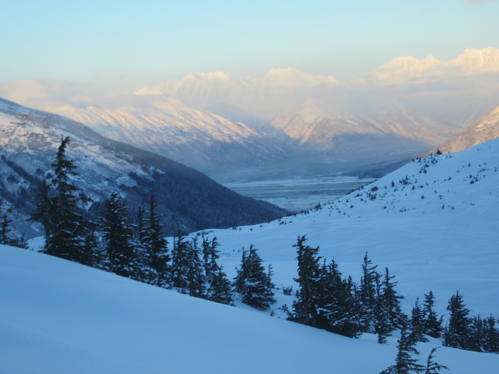
After a few weeks we packed up from Squamish and left without looking back, heading east into Alberta. We couldn't drive through Glacier National Park without having an adventure. These peaks are iconic and we needed to see more. Mt Tupper's neighbor, giant Mt. Sir Donald, is the true classic in the park.  It still had lots of snow on the ridge so we went over to climb the West Ridge of Mt. Tupper instead. We headed up towards Rogers Peak and the Swiss Peaks, then detoured over to this awesome ridge that we solo climbed. It was a 8,000 foot day up and down and the views and climbing were memorable.
Mt. Tupper
Rogers Pass, Glacier National Park, BC

Lots of scrambling on MT. Tupper

Ropeless 4,000 feet above the road on Mt. Tupper

Pitch 10 on Squamish Buttress 5.10c
 After checking out Lake Louise and the town of Banff we headed to Canmore, AB and got some beta about some classic climbing to get on. We quickly found out that there is lots of limestone sport climbing in Canmore, some of it covering entire mountains. They used to call this peak Chinamans peak because of the story of the man who first climbed up its south face, but these days it's known as Hai Ling Peak. The rock was surprisingly solid and we had a blast climbing its 1400 foot face in 5 hours casually.
Hai Lin Peak Canmore, AB


14 pitches of 5.6 on solid limestone
                                                  
Happy to be moving fast to beat the heat!
Good exposure

Great corner on Hai LIn
We didn't chance the Bugaboos because the weather was too fickle and our time was running out in Canada. We decided to drive to the Valhalla mountains outside of Nelson, B.C. These mountains are dramatic and not many climbers get out here to climb because of its remoteness. There is lots of potential for new routes here! We climbed the cleanest line in the range, the South Ridge of Mt. Gimli. The gnieiss was different then any route we had done in months and the moves and exsposure were fantastic. We climbed its 8 pitches in five hours with a lighntning storm on our ass, wow!
Mt. Gimli- Valhalla Mts, AB

Southeast Buttress of Mt. Gimli
Impeccable Gneiss on Mt. Gimli
We reentered the states in early August, driving through the smallest border crossing I have ever witnessed. There was only one guy working there- way more relaxed than the crossing in Vancouver. We stocked up on supplies in Mazama and hiked up to the Early Winter Spires and Liberty Bell. It felt great to get back on some granite. The mosquitos were heinous but we toughed it out to get up both South and North Early Winter Spire and the Becky route on Liberty Bell tower in two days of climbing.
Whats in a Dharma Bums pack?

Gonaa miss you guys!


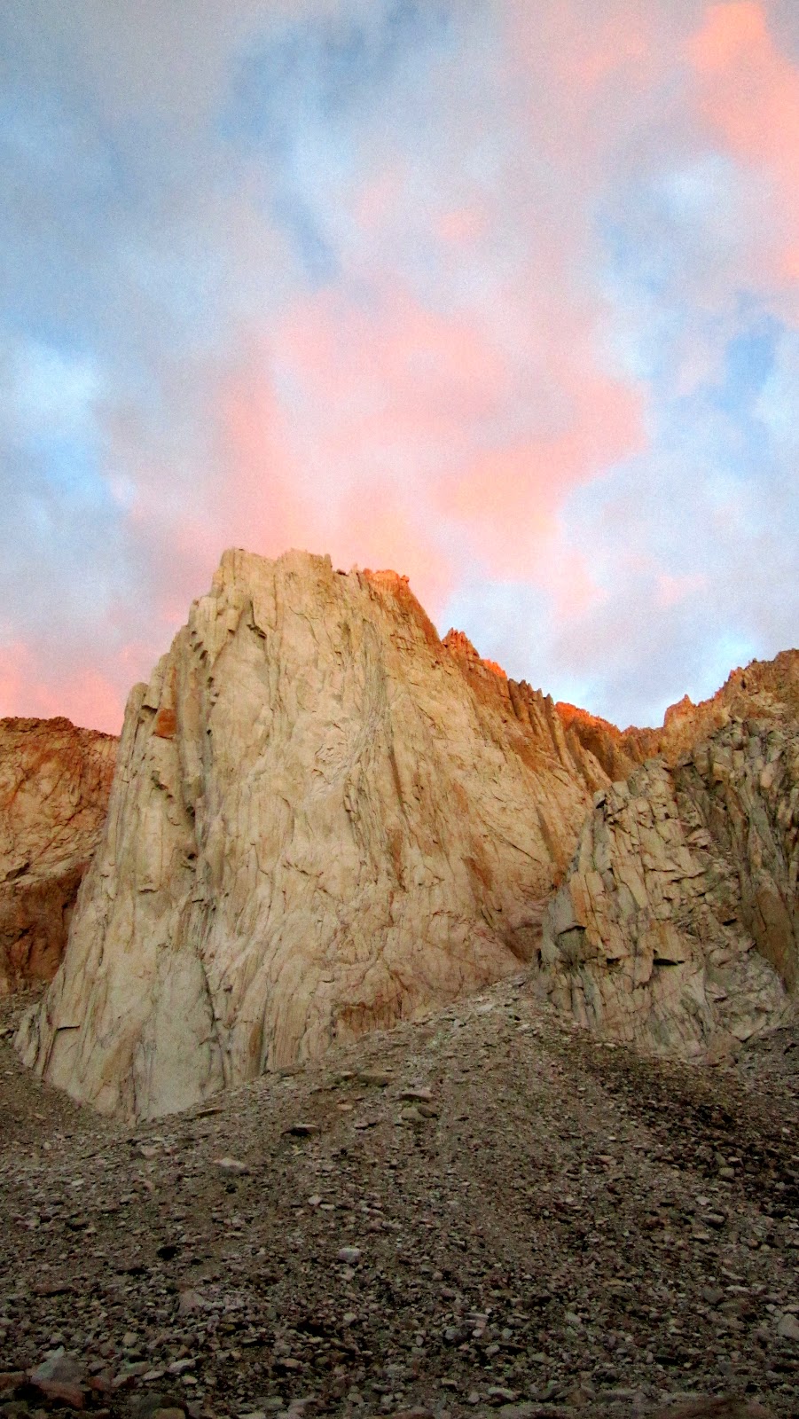
After running out of money we went to California for a couple of weeks and scored some work! It also gave us some time to reflect on what we had accomplished so far this summer. Getting back on the road we were excited to drive down into the Sierra mountains and meet up with our friends Justin and Olivia.  We pulled onto Tioga Road, sussed some camping outside the park, and planned out the next few days. The next day we got backcountry permits and backpacked out to climb Mathes Crest and Cathedral peak. Both of these routes are moderate ratings and the rock and views are as good as they get anywhere!
After the Tuolumne warm up we hiked into the Incredible Hulk outside of Bridgeport, CA. Peter Croft calls it the best alpine cliff in north America. We had to go. We climbed the Red Dihedral 5.10c in twelve pitches, taking ten hours on the route.
Hiking into Cathedral Peak
The south east face is rated 5.7

Mathes Crest
We simu climbed this mile long ridge

Gae leading the first pitch of Cathedral Peak

Summit Cone

Fun with ropes on the long exposed ridge of Mathe Crest

The Incredible Hulk

Gae leading the first pitch of Red Dihedral

Fraser on our heels the entire day!

Memorable pitch after Memorable pitch for twelve rope lengths

Fraser jamming the crux 5.10c pitch of Red Dihedral

Panthers on the top of the SIerra
Thanks Gaelen for being an incredible person to travel and climb with for five months and counting. Thank you for your sponsorship, I would have never done it with out your help. We had a blast and hope to be on the road again next summer following the same guidelines we have been. Live the Life you Love
Jah Buf