http://www.svtrek.com/
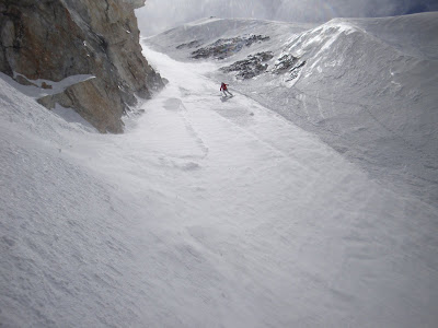
 This shot is from Duncans Ridge. The big peak in the back is the Devils Bedstead.
The Pioneer Mountains is a mountain range in the U.S. state of Idaho, spanning Blaine, Butte and Custer counties.
Hyndman Peak 12,009 ft (3,660 m)
Goat Mountain 11,913 ft (3,631 m)
Peak 11887 11,887 ft (3,623 m)
Standhope Peak 11,878 ft (3,620 m)
Devils Bedstead East 11,865 ft (3,616 m)
Brocky Peak 11,839 ft (3,609 m)
Altair Peak 11,825 ft (3,604 m)
Old Hyndman Peak 11,775 ft (3,589 m)
Duncans Peak 11,755 ft (3,583 m)
Pegasus Peak 11,736 ft (3,577 m)
The range is bounded on the west by the Big Wood River, Trail Creek, Summit Creek, and the North Fork Big Lost River, on the north and east by the East Fork Big Lost River, Left Fork Cherry Creek, Cherry Creek, Dry Fork Creek, Saint Louis Canyon, and Champagne Creek, and on the south by the Snake River Plain.

 The Pioneer Yurt is a 24 ’ diameter yurt that sleeps up to 16 people and has all the comforts you have come to expect from a cozy SVT backcountry hut: full kitchen, bunks with pads, wood and propane stoves, lanterns, library, and a great wood fired Sauna!
We approach Pioneer Yurt via Hyndman Creek off the East Fork of the Big Wood River. The ski into the yurt is roughly 6 miles and gains about 2000’ in elevation. The trip can be done in four to six hours by an average group of skiers. The area around the yurt is closed to snowmobiles before March 15th. Up until March 15, snowmobiles may be used to approach the first 5 miles to the yurt and after March 15th, may be used to get right to the yurt.
 If you come in the spring expect water crossings and wet heavy snow in the low elevations on your trek up to the Yurt.

 We called this peak No Name because on the maps we had it didn't have a name.
 Mckenna getting the first track down the Comma Couloir down Cobb.
 Axel carving his name in Cobb mountain.
 Back on the deck of the Pio Yurt just chilling.


