So far this season lots of work has made for few days of ski touring. But as I adjust to a routine of working in the resort and less scrambling in the mountains, I've been adequately compensated with many deep turns, as Northern Utah is off to a great start to the winter. Last week alone, I was lucky enough to open up the Patsy booter, twice, taking some extended work laps from the Supreme top shack. Once I was even smart enough to bring my skins and touring setup, but some deep-seated inner urge compelled me to thrash, hip deep, leaving a vertical boot pack straight up the Tuscarora Ridge.
This past weekend I was able to get out on my first extended tour, and with thousands of acres of quality powder to choose from, again, some masochistic urge compelled me to make a day that would be heavily lop sided in the hike-to-turn ratio.
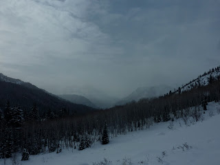
A Cloudy 'Merkin Fork.
With a day to burn and an insatiable appetite to hike, The Lizard and I agreed that the solitude of the upper reaches of American Fork Canyon would do good to clear our minds and harden our legs for the months of hiking ahead. So with an alpine start we caught the 100th chair of world-famous Collins lift, Ski-linking to the nearby Sugarloaf/USA-Snowbird Interconnect Dick Bass Memorial RFID Scan station. After securing the proper paperwork and undergoing a full body scan, we were granted permission to pass through the knee-bashing gates of hell and slide our way into the upper reaches of Mineral Basin.
Once past the chairlift and out of the ski area boundary our adventure began. Snowmobile tours are in effect, so as Liz and I glided and skated our way out the first bit cat-track, a skier-cross vs snowmachine race ensued, with Liz and I coming out well ahead. After a few miles the grade eased and we found ourselves skating and polling more then gliding. With thick trees and a low cloud cover, it was tough to identify how many drainages we'd passed, but breaks through the haze showed us that Timp and Box Elder appeared closer than before and we agreed that it might be time to turn right and start hiking.
Mining roads make for good skin tracks.
Although it was a cold morning in Alta, we'd lost so much altitude that we found ourselves shedding more and more layers as we climbed, skinning through the thinner snowpack south of LCC. Hoping for some views to help us figure out exactly where we were, we continued on, higher and higher. Summiting our first hill, views were scarce but we had enough to figure we were somewhere west of Mary Ellen Gulch.
Approaching the Twins.
Continuing on we gained the next ridge and the clouds began to break. The landscape around us opened up and the views were stunning. Ahead lay American Fork Twin East, and some tempting steep coloirs fell away to our right. After summiting both of the American Fork Twin's, we made our way to the White Pine divide, where we finished the rest of our food and water and prepared for our descent to the valley below.
Lizards love snow.
With multiple storms of light density snow and little wind, it was surprising to find our only skiing of the day with a challenging wind crust. But we struggled through it and as we continued to lose altitude, the snow got softer and the turning easier. Before we reached White Pine Lake we hung another right and made to find a skin track that would afford us some easy gliding back towards the trailhead. The light was fading but we paused to take in some of the beautiful sunset over SLC, a thick inversion made sure that the city was invisable, making our wilderness experience all the more complete. In fact, after leaving Snowbird and passing a party of 5 snow-machiners, we encountered and heard no one until looking down from the Twins into Snowbird, and didn't even really see anyone except for passing a lone skier making his way back to the trailhead. Not to bad for a day of hiking in Was Angeles.
Reasons to return.
The day ended up being great, giving the legs a stretch and reminding me why I love to explore and giving me plenty of reason to return to the Mary Ellen/Major Evans area, although I'd have to say that hiking up from 210 is prrobably the easier option.
As a side note we didn't partake in the mass-Sugarhousing of Mt. Superior late last week, in which nearly a third of SLC appeared to have skied its south face. We did, however, manage to motivate New Year's Day and claim some good turns on what was most likely her first descent of the new year. Sorry, no pictures from that as the wind was pounding enough to make the ridge walking pretty miserable.
Happy new year boyz! Lets make it a good 'un.


No comments:
Post a Comment